Municipal Protected Areas Project (M.P.A.P.)
Protected areas play an essential role in supporting biodiversity and reducing the impacts of climate change. Protection of biodiverse natural areas requires an ‘all-hands-on-deck’ approach, whereby all levels of government, industry, private business, and the public sector need to work collectively. Local governments own and manage large amounts of important natural areas, each using different systems of protection for these spaces. As part of the MPAP we are supporting local governments to make sure these protections align with international standards.
Canada and British Columbia have both committed to protecting 30% of land and water (including oceans and inland water) by 2030, known as the “30×30” goal. To date, provincial and federally protected land has been identified, but the amount protected by local governments is still unclear. To count towards this 30×30 goal, areas must:
- Have clearly defined geographic boundaries
- Achieve in-situ conservation of biodiversity
- Prohibit actions incompatible with conservation
- Are intended to be protected in perpetuity
As of December 2023, Canada has 13.7% of its terrestrial area protected while BC has 19.7% of its terrestrial area protected. Reaching 30×30 will require a continued coordinated effort amongst all management authorities of conservation areas. To ensure the MPAP work is aligned across the country, BC Nature works with a coalition of four other nature organizations: Nature Canada, Ontario Nature, The Alliance of Canadian Land Trusts, and Wildlands League.
UPDATE: June 2026
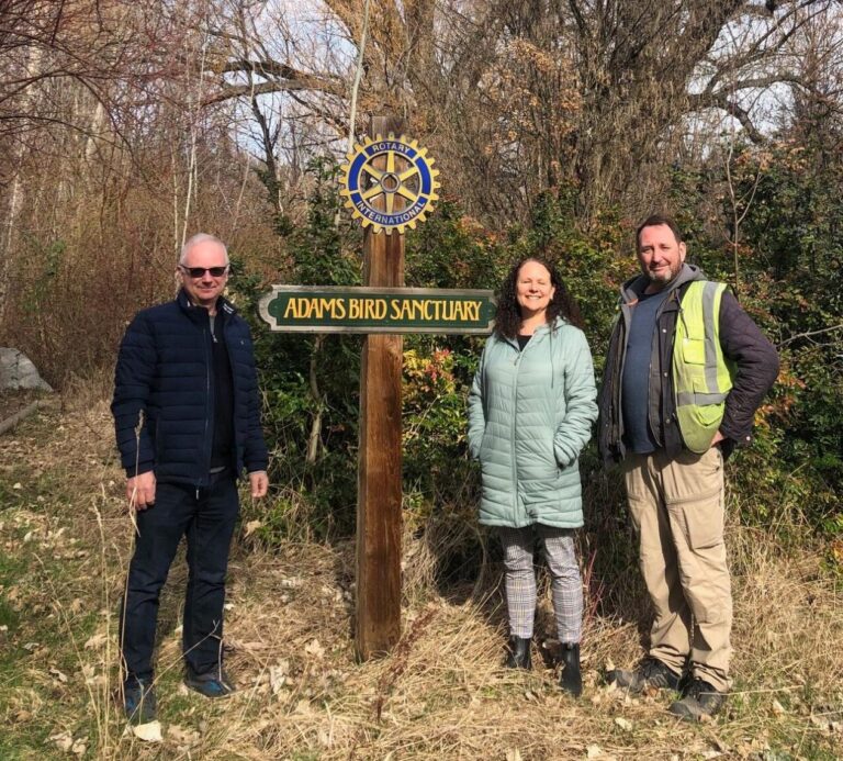
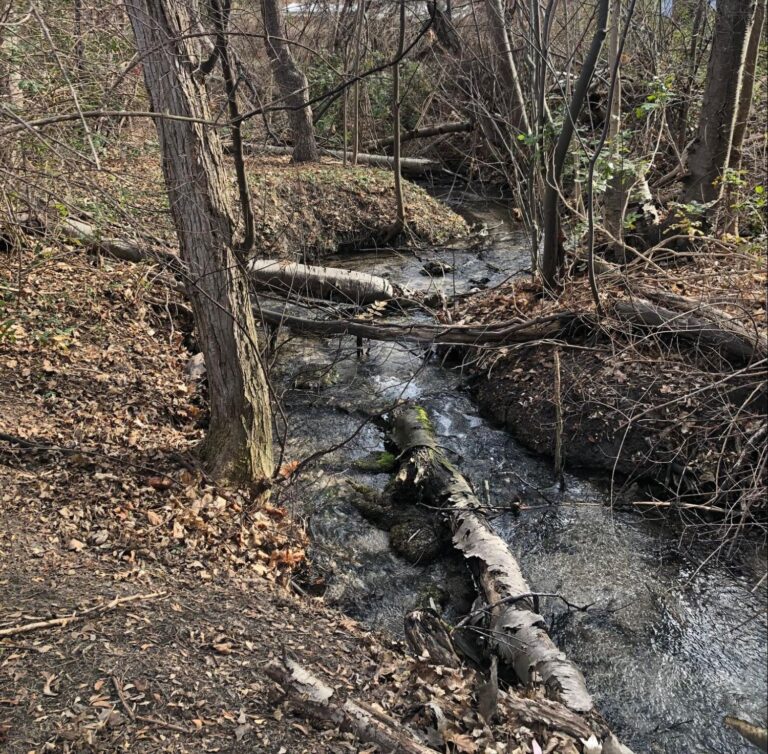
The District of Summerland, British Columbia: In 2025, the District of Summerland registered 330 hectares of biodiverse municipal parkland in Canada’s Protected and Conserved Areas Database, including the Adams Bird Sanctuary, a cherished community green space. Link to 2026-06-10 Media Release – Summerland Protected Areas
UPDATE: January 2026
Since beginning this work in 2023, BC Nature has supported nine local governments (seven municipal and two regional districts) and one Crown Corporation to assess and register 253 new Protected Areas and 67 OECMs in the Canadian Protected and Conserved Areas Database (CPCAD), representing 10,822 hectares of biodiverse near-urban land formally recognized for biodiversity conservation. While modest in scale nationally, these areas hold exceptional ecological, cultural, and community value and are among the most biodiverse, and most threatened, landscapes in BC.
BC Nature has significantly expanded its CPCAD registration efforts each year. We began in 2023 with 10 sites in the Resort Municipality of Whistler. In 2024, we registered 106 sites across five local governments including the City of Vancouver, Bowen Island Municipality, Comox Valley Regional District, Lion’s Bay Village, and Metro Vancouver Regional District. In 2025, we doubled that impact by submitting 203 sites on behalf of the City of Surrey, the Village of Nakusp, and the District of Summerland along with three sites for a Crown Corporation, which will be published in the database this spring. Our continued growth reflects ongoing learning and the development of more effective strategies to support local governments in this work.
This growth has been enabled by strong partnership development and public outreach in support of Canada’s 30 by 30 goals, including collaboration with local nature clubs to collect biodiversity data, national advocacy such as participation in Nature on the Hill in Ottawa and CBC News interviews, regular coordination with coalition partners, and targeted regional outreach to support Protected Area and OECM development, foster regional collaboration, and strategically focus efforts on landscapes with the highest biodiversity value.
Check out our Coalition’s website for more information about the project across the country Read More
Participation in the Municipal Protected Areas Project is free to local governments and involves an assessment of natural areas using the nationally recognized Decision Support Tool process. The assessment incorporates both ecological value and the policy strength of protective mechanisms. BC Nature undertakes the majority of the assessment and registration process to reduce the capacity constraints of local governments. BC Nature also works with their local clubs, gaining valuable monitoring data, local knowledge and connections that are integral to the success of this program. Read more about the pilot project in Whistler to see how the process can go!
Take-aways:
- Don’t let the name fool you! This project is open to regional districts, municipalities, watershed management authorities, First Nations, and more.
- The 30×30 target is being tracked on the Canadian Database of Protected and Conserved Areas (CPCAD).
- Your local government does not need to protect 30% of its land to help contribute to this goal, every bit helps.
Want to learn more?
Please reach out to Andrew Banks via the email below: